|
Geospatial PDF files
|   |
|
Geospatial PDF files
| |
A PDF file can be geo referenced using the Geospatial PDF specification, which is part of the PDF 2.0 specification.
Condes supports Geospatial PDF, and PDF files exported from Condes are geo referenced, provided that the map file used is geo referenced and a reference coordinate system is defined.
Condes places information in the PDF file that indicates the latitude and longitude of each of the four corners of the map. Based on this information, applications such as Adobe Reader and Avenza Maps can show you the latitude and longitude of positions on the map.
Inspect a PDF file in Adobe Reader
You can inspect a PDF file by using Adobe Reader.
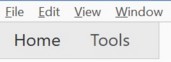
After opening the file in Adobe Reader, first use the "Tools" option,
then the "Measure" option,
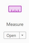
and select the "Geospatial Location Tool".

Once you have done that, and move the cursor around on the map, a pop-up box shows the latitude and longitude of the current cursor position.
Note that when the reference coordinate system used is not WGS 84, inaccuracies may occur in the latitude/longitude shown in Adobe Reader, unless you uncheck this box

in the Edit / Preferences / Measuring (Geo) menu.